
Dry Lakes Racers Australia Inc
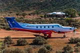
Mt. Ive Air Strip
Mt. Ive Airport - South Australia
83 km NNW of Kimba MT IVE
16 km to the edge of Lake Gairdner
| Airport codes | YMIV | |
| Type | local airport (light traffic) | |
| Airline Service | No | |
| Runways at Mount Ive Airport | ||
| 04-22 | 3,116 ft (950 m) Surface other (N), not lighted. |
|
| 07-25 | 2,460 ft (750 m) Surface other (N), not lighted. |
|
| Altitude | 189.05m | |
| Latitude | -32.444199 | 32 26.651917 S | S32 26 39 | |
| Longitude | 136.069000 | 136 4.140015 E | E136 04 08 | |
| Radio frequencies for Mount Ive Airport | ||
| CTAF | 123.9 MHz | |
| MISC | 122.1 MHz | |
| Channel | 7 Callsign: UNO07 | |
Source: Pilot information for Mount Ive Airport (http://www.ourairports.com/airports/YMIV/pilot-info.html)
Nearby Airstrips
Kolendo Airstrip
[Airport] Pos: -32.41626 136.29731 Alt: 207.46m
Orientation 15°.
Top Tank 60 Km West Of Woomera Wirraminna Station
[UHF] Pos: -32.53417 136.21139 Alt: 196.01m
Channel: 1 Callsign: VLF7
Airstrip
Airstrip
[Airport] Pos: -32.43756 135.78217 Alt: 231m
Orientation 35°.


